QLD Severe Weather Warning: Heavy Rain
Source: Bureau of Meteorology
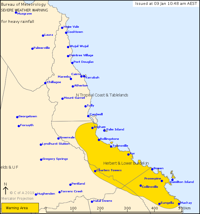
For people in Herbert and Lower Burdekin and parts of Northern Goldfields and Upper Flinders and Central Coast and Whitsundays Forecast Districts.
Issued at 10:48 am Wednesday, 9 January 2019.
Locally heavy rain developing between Mackay and Ingham, particularly with thunderstorms.
Weather Situation: At 10 am AEST Wednesday, ex-tropical cyclone Penny was a weak tropical low and located near Gloucester Island, east of Bowen. Ex-tropical cyclone Penny is not expected to re-intensify in the Coral Sea.
A trough associated with ex-tropical cyclone Penny is expected to move northwards along the tropical east coast in the next 24 to 36 hours and may lead to areas of heavy rainfall, particularly with thunderstorms.
Locally heavy rainfall, which may lead to flash flooding, is expected to develop through today in coastal and adjacent inland areas between Mackay and Ayr, particularly with thunderstorms.
Through Thursday, this zone of heavier rainfall should move further north to coastal and adjacent inland areas between Proserpine and Ingham.
Isolated six hourly rainfall totals between 150mm and 180mm are possible.
Locations which may be affected include Mackay, Proserpine, Bowen, Ayr, Charters Towers, Townsville, Rollingstone and Ingham.
Severe weather is no longer occurring in the Central Highlands and Coalfields and Capricornia districts and the warning for these districts is CANCELLED.
Preston, east of Proserpine, recorded 167 mm in 6 hours to 2am Wednesday.
Queensland Fire and Emergency Services advises that people should:
* Never drive, walk or ride through flood waters. If it's flooded, forget it.
* Keep clear of creeks and storm drains.
* For emergency assistance contact the SES on 132 500.
 |


 Help | Log In | Alerts Map | Register | Unsubscribe
No comments:
Post a Comment