Source: Bureau of Meteorology
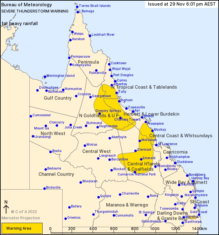
For people in Herbert and Lower Burdekin and parts of North Tropical Coast and Tablelands, Northern Goldfields and Upper Flinders, Central Coast and Whitsundays, Central Highlands and Coalfields, Central West, Southeast Coast, Capricornia and Darling Downs and Granite Belt Forecast Districts.
Issued at 6:01 pm Tuesday, 29 November 2022.
Isolated heavy rainfall with thunderstorms
Weather Situation: Areas of slow moving thunderstorms are continuing to develop about the North Tropical Coast and highlands, as well as over the Central Coast and highlands and parts of the far south east near the NSW border.
Severe thunderstorms are likely to produce heavy rainfall that may lead to flash flooding in the warning area over the next several hours. Locations which may be affected include Emerald, Mackay, Charters Towers, Blackwater, Moranbah and Carnarvon National Park.
Sutties Creek (inland of Innisfail) recorded 63mm in the 1 hour to 1:47pm
Glen Allyn (Atherton Tablelands) recorded 53mm in the the 30 minutes to 4:12pm
Scrubby creek (Atherton Tablelands) recorded 61mm in the 1 hour to 4:41pm
Moranbah Airport recorded 58.2mm in the 1 hour to 4:45pm
Queensland Fire and Emergency Services advises that people should:
* Never drive, walk or ride through flood waters. If it's flooded, forget it.
* Seek shelter, preferably indoors and never under trees.
* Avoid using the telephone during a thunderstorm.
* Beware of fallen trees and powerlines.
* For emergency assistance contact the SES on 132 500.


No comments:
Post a Comment