Source: Bureau of Meteorology
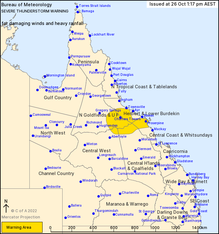
For people in parts of Northern Goldfields and Upper Flinders, Herbert and Lower Burdekin, Central Coast and Whitsundays, Central Highlands and Coalfields and Central West Forecast Districts.
Issued at 1:17 pm Wednesday, 26 October 2022.
Thunderstorms have developed this afternoon.
Weather Situation: A moist unstable airmass and a trough have triggered thunderstorms this afternoon and are expected to continue in the evening.
Severe thunderstorms are likely to produce damaging winds and heavy rainfall that may lead to flash flooding in the warning area over the next several hours. Locations which may be affected include Proserpine, Charters Towers, Collinsville, Pentland, Mingela and Giru.
Queensland Fire and Emergency Services advises that people should:
* Move your car under cover or away from trees.
* Secure loose outdoor items.
* Never drive, walk or ride through flood waters. If it's flooded, forget it.
* Seek shelter, preferably indoors and never under trees.
* Avoid using the telephone during a thunderstorm.
* Beware of fallen trees and powerlines.
* For emergency assistance contact the SES on 132 500.


No comments:
Post a Comment