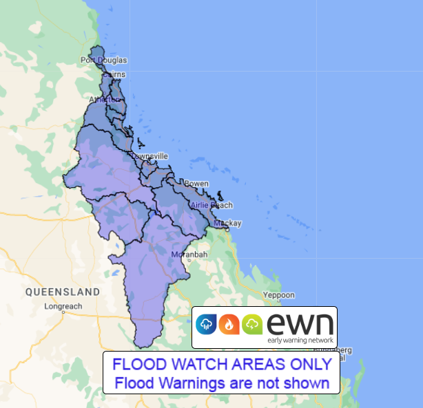
QLD Flood Watch: Coastal Catchments from Whitsunday Islands to the Daintree
Source: Bureau of Meteorology
Issued at 1:01 pm EST on Thursday 21 April 2022 Flood Watch Number: 2
MINOR FLOODING LIKELY FROM FRIDAY WITH ISOLATED MODERATE RIVER LEVELS AND HIGHER POSSIBLE
A surface trough located over the northwestern Coral Sea is forecast to deepen while moving onto the northeast tropical coast late Thursday. The trough is expected to deepen further and become slow-moving on Friday before shifting north of Cairns early on Saturday.
The Flood Watch area has been extended further south to include coastal catchments down to the Whitsunday Islands, including the Townsville area.
Catchments are slowly wetting up during Thursday from rain areas and isolated thunderstorms across parts of the Flood Watch area.
Areas of heavy to very heavy rainfall is forecast from Thursday evening and into Friday to mainly coastal areas from the Whitsunday Islands to the Daintree. Daily totals up to 200 mm are forecast, with isolated higher totals in excess of 300 mm possible with areas of heavy rainfall particularly to the Cassowary Coast.
A Severe weather Warning is current for heavy rainfall, and locally intense rainfall to develop Thursday evening.
Areas of minor flooding is likely from Friday, with higher levels and at least moderate flooding possible at isolated locations. This rainfall is expected to cause disruption to transport routes within the Flood Watch area.
Catchments likely to be affected include:
Daintree River
Mossman River
Barron River
Mulgrave and Russell Rivers
Johnstone River
Tully River
Murray River
Herbert River
Black River
Ross and Bohle Rivers
Haughton River
Belyando and Suttor Rivers to Burdekin Falls Dam
Cape River to Burdekin Falls Dam
Burdekin River to Burdekin Falls Dam
Burdekin River downstream of Burdekin Falls Dam
Don and Proserpine Rivers
See www.bom.gov.au/qld/warnings to view the current flood and cyclone products for Queensland.
For more information on the Flood Watch Service:
http://www.bom.gov.au/water/floods/floodWarningServices.shtml
Flood Safety Advice:
This Flood Watch means that people living or working along rivers and creeks should monitor the latest weather forecasts and warnings.
Remember: If it's flooded, forget it.
For flood emergency assistance contact the SES on 132 500.
For life threatening emergencies, call Triple Zero (000) immediately.
Current emergency information is available at www.qld.gov.au/alerts.
This advice is also available by dialling 1300 659 219 at a low call cost of
27.5 cents, more from mobile, public and satellite phones.
Warning, rainfall and river information are available at www.bom.gov.au/qld/flood/
Rainfall and River Conditions Map
 |


No comments:
Post a Comment