QLD Severe Weather Warning: Heavy Rain
Source: Bureau of Meteorology
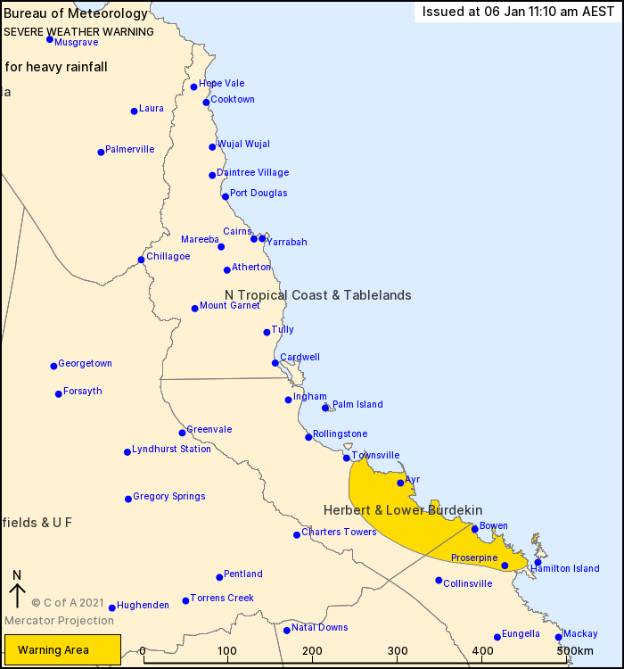
For people in parts of Herbert and Lower Burdekin and Central Coast and Whitsundays Forecast Districts.
Issued at 11:10 am Wednesday, 6 January 2021.
HEAVY RAIN POSSIBLE BETWEEN MT STUART AND PROSERPINE TODAY INTO THURSDAY.
Weather Situation: The remnants of ex-tropical cyclone Imogen and a coastal trough are triggering widespread rain areas, heavy showers and thunderstorms for parts of the northeast tropics and towards the central coast.
HEAVY RAINFALL which may lead to flash flooding is possible with six hourly totals between 130 mm to 180 mm. The heaviest rainfall is currently occurring just offshore, and is expected to come onshore in the warning area later today. The risk of severe thunderstorms exists elsewhere about the northeast tropics and central coast, and warnings will be issued as necessary.
A Flood Watch and various Flood Warnings are current in nearby areas. Refer to those products for more information regarding riverine flooding.
Locations which may be affected include Bowen, Ayr, Proserpine, Giru, Alva Beach, Airlie Beach and Clare.
Selected rainfall observations in the 6 hours to 11am include:
Ingham 240mm.
Queensland Fire and Emergency Services advises that people should:
* Never drive, walk or ride through flood waters. If it's flooded, forget it.
* Keep clear of creeks and storm drains.
* For emergency assistance contact the SES on 132 500.
 |

 Help | Log In | Alerts Map | Register | Unsubscribe
No comments:
Post a Comment