QLD Severe Weather Warning: Damaging Winds & Heavy Rain
Source: Bureau of Meteorology
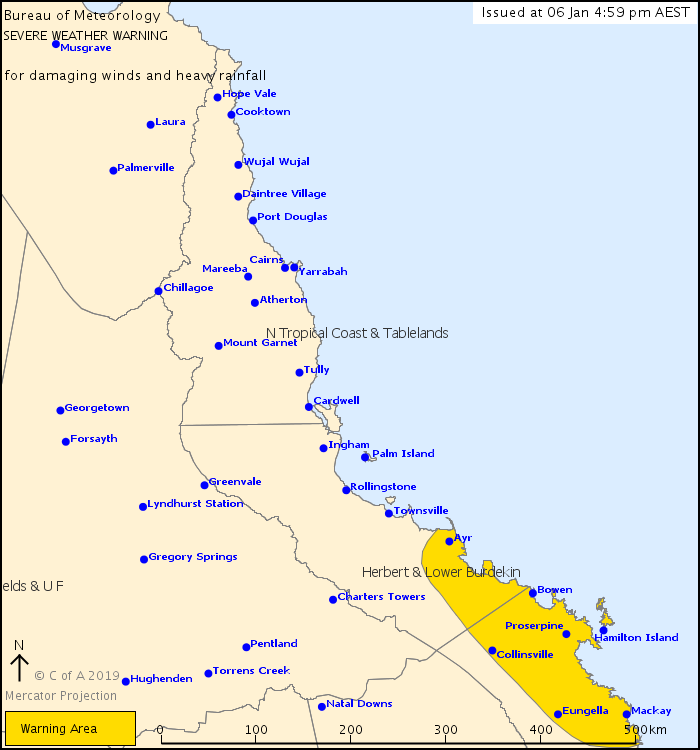
For people in parts of Herbert and Lower Burdekin and Central Coast and Whitsundays Forecast Districts.
Issued at 4:59 pm Sunday, 6 January 2019.
Heavy rain and damaging wind gusts to develop between Alva Beach and Sarina from Monday evening
Weather Situation: At 4pm AEST Sunday, ex-tropical cyclone Penny was located in the Coral Sea near latitude 17.0 degrees south, longitude 154.5 degrees east, about 740 kilometres east to northeast of Bowen.
Over the next few days, the system is forecast to move further west towards the tropical east coast of Queensland, most likely as a tropical low. There is still some risk that the system will redevelop into a category 1 tropical cyclone over the western Coral Sea. However, regardless of its status, heavy rainfall and damaging winds are likely to develop with its passage.
Areas of heavy rainfall, which may lead to flash flooding, are expected to develop over the southern flank of the system from Monday evening. Heavy rain should initially develop about coastal areas between Alva Beach and Sarina, and extend inland during Tuesday. Six hourly rainfall totals between 140mm and 180mm are possible, with isolated heavier falls in excess of 200mm possible.
Damaging winds, with peak gusts of around 90km/h may develop over the Whitsunday Islands from Monday evening or Tuesday morning.
Locations which may be affected include Mackay, Bowen, Ayr, Proserpine, Collinsville, Hamilton Island, Eungella, Alva Beach, Airlie Beach and Clare.
Queensland Fire and Emergency Services advises that people should:
* Move your car under cover or away from trees.
* Secure loose outdoor items.
* Seek shelter, preferably indoors and never under trees.
* Beware of fallen trees and powerlines.
* Never drive, walk or ride through flood waters. If it's flooded, forget it.
* Keep clear of creeks and storm drains.
* For emergency assistance contact the SES on 132 500.
 |


 Help | Log In | Alerts Map | Register | Unsubscribe
No comments:
Post a Comment